
 then open in external browser


 and click "Open in External Browser"
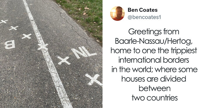
Hey there! Today, we're diving into the wild world of borders that look like someone *totally* goofed up the map. Picture countries playing peekaboo, borders running through libraries, and tiny islands that change countries like they switch socks. Ready? Let's jump in!
This post may include affiliate links.
Baarle-Hertog & Baarle-Nassau: The Border Jigsaw Puzzle
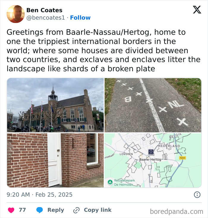
Zoom in on this corner of the southern Netherlands and Belgium, and your brain might start doing somersaults. Baarle-Hertog (Belgium) and Baarle-Nassau (Netherlands) are so mixed up that there are 30 tiny enclaves all tangled together. Think of a country sandwich! 22 Belgian little spots inside the Netherlands and then 7 tiny Dutch bits inside those Belgian bits.
Imagine walking down the street where you might step from Belgium to the Netherlands and back - all without feeling a thing! Buildings even have white crosses on the road or flags flying to clue you in which country you’re in.
This mess started ages ago with medieval land swaps. When Belgium became its own country, the folks drawing borders just threw up their hands and said, “Good luck!”
Fun legal fact: if a building is split between countries, the front door’s location decides the country. Sneaky people have moved doors to get better taxes or services. Border hopping like a pro!
Bonus? Both countries are in the Schengen zone, so passport checks are a thing of the past. You can stroll through Belgian bakeries and Dutch supermarkets without border drama. Cool, right?

Caprivi Strip: Germany’s Oopsie in Africa
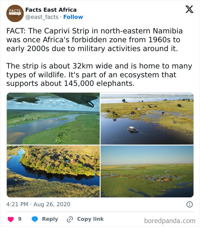
Meet the Caprivi Strip - Namibia’s long, skinny finger poking toward Zimbabwe. It looks cool, but it’s actually a big whoops from Germany’s colonial days. Back in 1890, Germany wanted a shortcut to Tanzania and thought this strip was the magic ticket.
They traded Zanzibar rights with Britain for this land, only to find out the route was blocked by waterfalls like the massive Victoria Falls - totally unusable!
So here it is, a corridor to nowhere. But hey, it’s a great spot for a safari now, full of elephants, hippos, and tons of birds. Germany might not have used it, but we get to enjoy the wildlife!
India-Bangladesh Enclave Madness
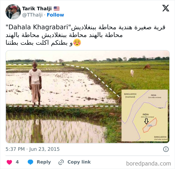
Think town inside another town? How about a country inside a country inside a country inside a country?! The India-Bangladesh border used to be like one big nesting doll mess with 111 Indian spots inside Bangladesh and 51 Bangladeshi spots inside India.
There was even one crazy little piece called Dahala Khagrabari - a Bangladeshi enclave wrapped inside an Indian enclave wrapped inside a Bangladeshi enclave inside India. Yep, layers galore.
The problem? Residents had no real citizenship and couldn’t visit schools or hospitals easily. Thankfully, in 2015, both countries swapped these enclaves and gave people a choice of where to live. Phew!
Pheasant Island: The Island That Tags Between Two Countries
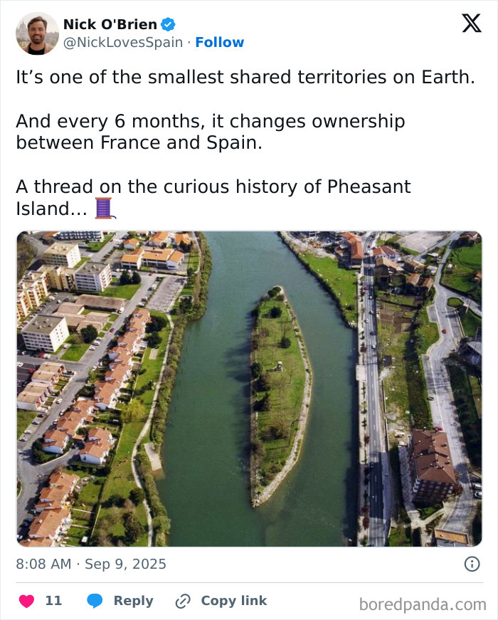
No pheasants here, but lots of action! Pheasant Island floats between France and Spain and is the world’s only island that swaps countries every six months. Spain owns it from February 1 to July 31, then France takes over from August 1 to January 31.
This quirky arrangement came from centuries-old rivalries and a peace treaty signed right on the island. Every half year, officials come to do the paperwork and hand over the keys - like a very slow game of hot potato!
If you’re thinking of visiting, better check the calendar to see if you’re stepping into French or Spanish territory. Heads up: it’s not tourist-ready, but it’s a hilarious border story nonetheless.
Bir Tawil: The Land Nobody Wants
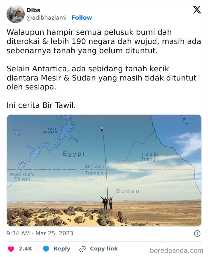
Bir Tawil is the ultimate ‘You can’t have it’ piece of land. Nestled between Egypt and Sudan in the Sahara, nobody claims it because both countries want the fancier Halaib Triangle instead.
The confusion started with two different maps in 1899 and 1902 that flipped territories. Since both countries want Halaib’s resources, Bir Tawil got shrugged off and left unclaimed. It’s like the world’s loneliest patch of sand.
Some folks have even tried to claim it themselves. In 2014, a guy named Jeremiah Heaton called it “The Kingdom of North Sudan” just so his daughter could feel like a real princess. How’s that for unusual real estate?
Diomede Islands: Two Islands, Two Countries, One Crazy Time Gap
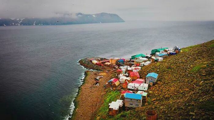
These tiny islands sit just four kilometers apart but feel like a time travelers’ playground. Big Diomede belongs to Russia and is about 21 hours ahead of Little Diomede, which is part of the USA (Alaska, to be exact).
The International Date Line slices right between them, meaning they’re not just different countries but on totally different days. It’s like stepping into tomorrow or back into yesterday with one giant hop!
During World War II, the Russians turned Big Diomede into a military base and cleared out the residents, sealing it off from the US side forever. Meanwhile, Little Diomede stays home to hardy Alaskan folks.
Derby Line: The Border That Runs Through A Library!
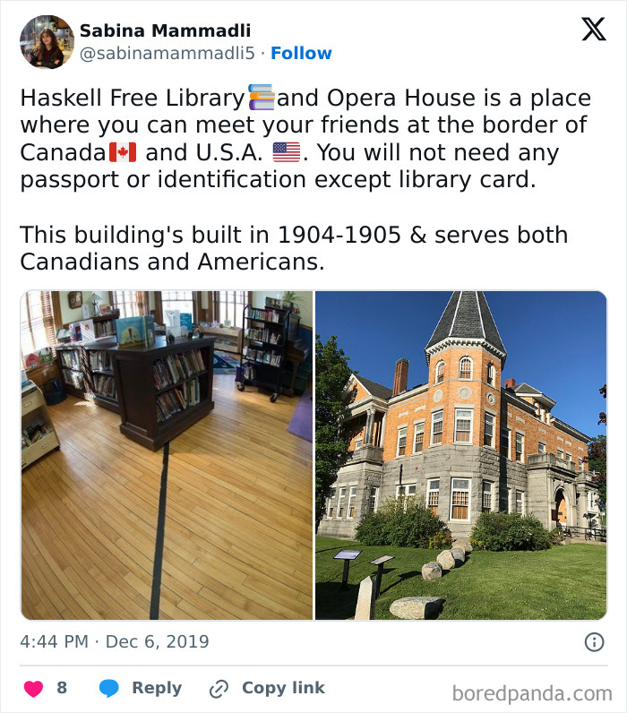
Ever thought about standing in two countries at once? Derby Line, on the US-Canada border, lets you do just that - even inside a library. The Haskell Free Library and Opera House sits smack on the border between Vermont and Quebec, with a line right down the middle of the floor.
You can literally sit with one foot in Canada and the rest of you in the US, all while reading a book. Talk about international culture!
During some rough travel ban times, families separated by the border used this library as a sneaky meeting spot. It’s one of the rare places where borders don’t feel like a barrier but more like a quirky neighborhood line.
Nahwa-Madha: A Country Sandwiched Inside Another Inside Another
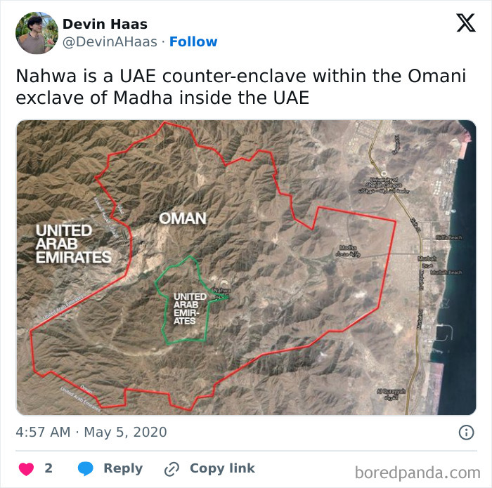
Welcome to the border version of a nesting doll! In the Middle East, the UAE and Oman share a wacky setup where you’ve got Oman’s Madha inside the UAE, and then the UAE’s Nahwa nestled inside Madha. A country inside a country inside a country - like a donut with a hole that’s another donut!
This odd shape comes from local leaders pledging their loyalty differently hundreds of years ago. Thanks to British border nerds in 1969, lines got drawn and this funny mix became official.
Crossing here is super chill - no passports, just flags and roads marking where you are. It’s like hopping between cities on a magical magic carpet ride!




Point Roberts: You Can’t Drive Here Without Crossing Another Country
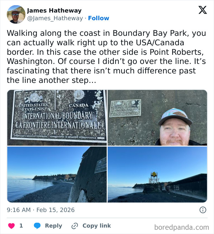
Point Roberts is a tiny US town stuck on a peninsula below the 49th parallel but cut off from the rest of the country by Canada. It’s totally American but you have to go through Canada to get there or leave.
Thanks to a border line drawn back in 1846, this corner of Washington state is an island politically but not geographically. It’s like having a neighborhood where to visit your next-door neighbor, you have to passport check twice!
During COVID, when borders closed, residents were basically stranded in their own country. A special task force had to step in just to help with basic stuff. Even a simple grocery run means border checks twice - yikes!
Wakhan Corridor: Afghanistan’s Skinny Border Buffer
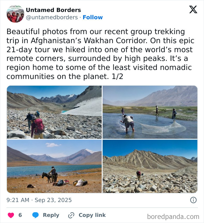
Picture a tail poking out of Afghanistan - that’s the Wakhan Corridor. This wafer-thin strip stretches between Tajikistan and Pakistan and just barely touches China at the tip.
Why the skinny shape? Back in the 19th century, Britain and Russia didn’t want their empires to share a border, so they stuck Afghanistan in between like a buffer zone.
The corridor slices through the lives of the Wakhi people who now live spread across different countries. It’s remote and tough, with minimal services, but it’s one of the few spots on Earth where four countries almost meet in one place. Borders are wild!
Quick Brain Snacks:
The wildest border ever?
That’s gotta be Baarle-Hertog/Baarle-Nassau. Imagine 30 enclaves all tangled up like a knot of yarn!
Also, Nahwa-Madha in the UAE and Oman takes the cake for being a border-ception - a country inside a country inside a country!
Oddest US state border?
Kentucky has a wacky little bend called the “Kentucky Bend” that you just can’t miss.
Most head-scratching map design?
Yep, the Baarle combo wins here with its crazy twists and turns.
Fun fact about Michigan?
It’s shaped like a mitten. Yep, a mitten. And it’s split into two peninsulas with lakes all around. Wild.


45
0