
 then open in external browser


 and click "Open in External Browser"
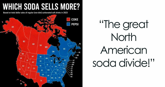
Hey! Ready to dive into some maps that are way cooler than your usual "find the nearest pizza place" map? Let's check out some maps that show off all sorts of fun, weird, and surprising stuff about countries and cultures. Grab your curiosity cap!
This post may include affiliate links.
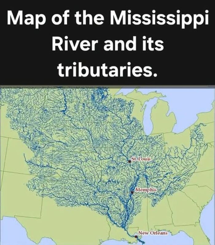

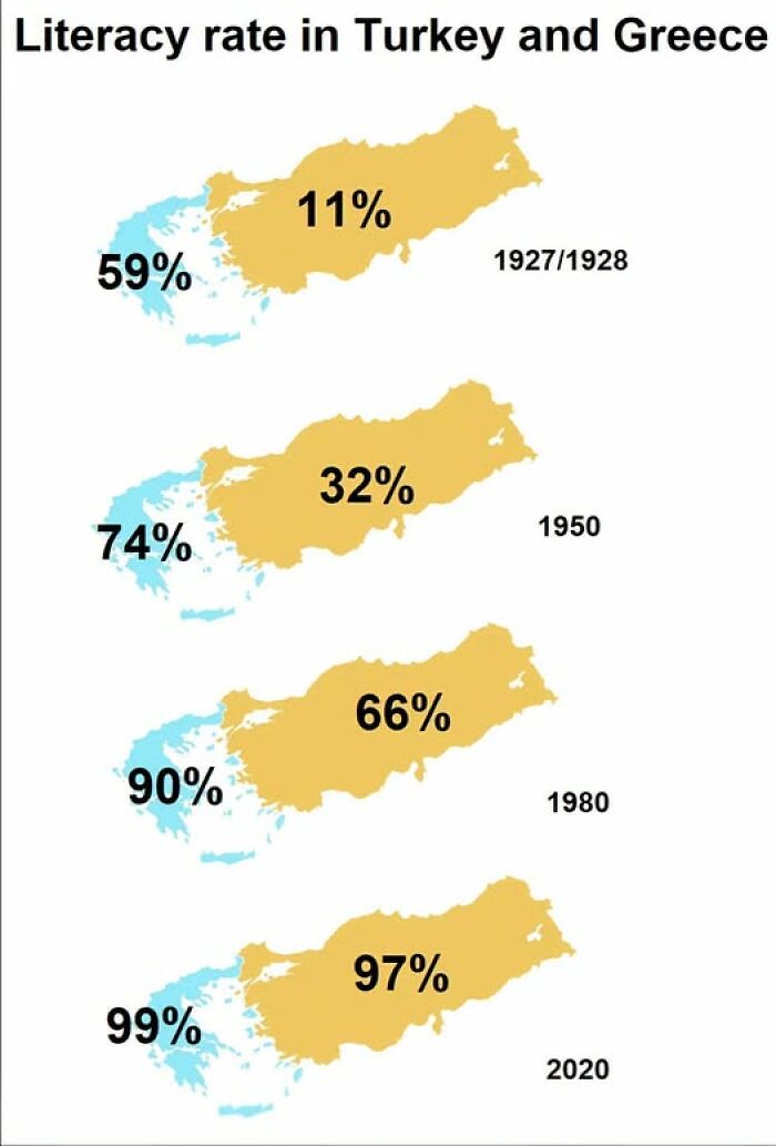
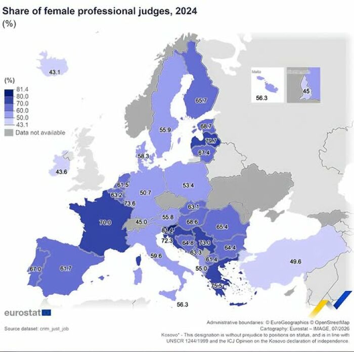
Maps are like the magical sidekicks of our daily adventures. We pull them out to see when the bus shows up, to hunt down a cozy cafe, or to find the fastest way home without turning into a lost tourist zombie.
Even locals can’t resist whipping out their phones when they wander somewhere new. Believe it or not, over 2 billion folks peek at Google Maps every month! That’s a LOT of thumb scrolling.
Feeling 'Whey' Too Much Dairy? You’re Probably Not Alone, Depending On Where Your Family’s From
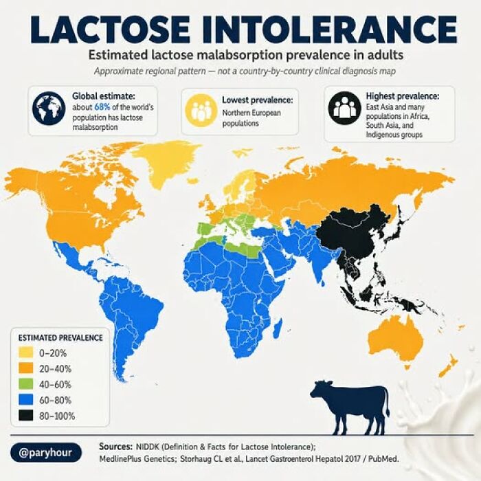
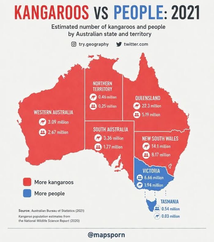
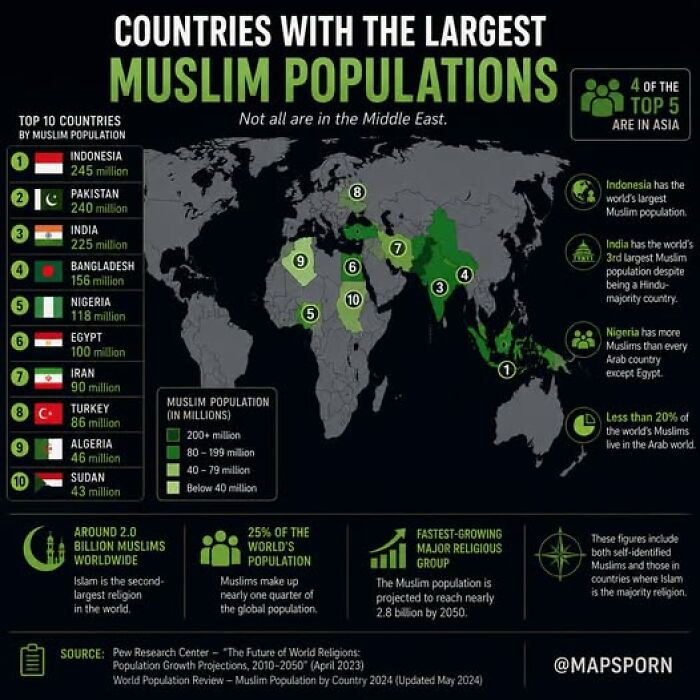
But maybe we’ve gotten a little too comfy with always having a digital map in our pocket. A survey found that more than half of millennials would get seriously lost without their phones telling them where to go.
And guess what? A chunk of people have never even unfolded a paper map! Imagining that is kind of mind-boggling.
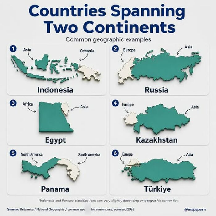
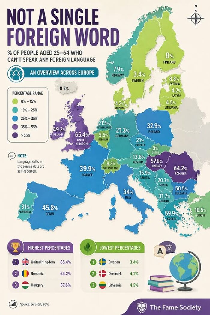
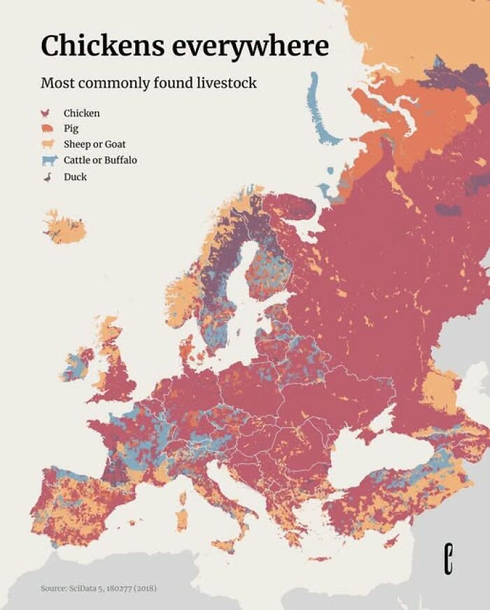
Maps have come a long way from just scribbles on clay tablets. Turns out, one of the oldest maps ever was made around 700 BC and it basically put Babylon right smack in the middle of everything.
Back then, it wasn’t about giving directions - it was like holding a little world magic talisman in your hands!
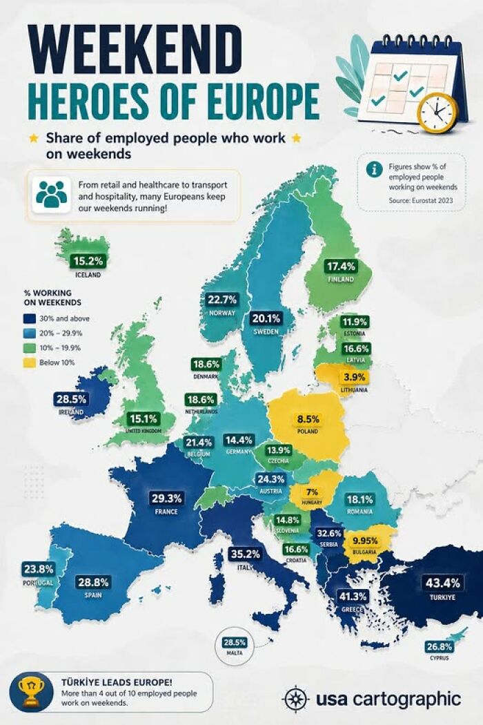
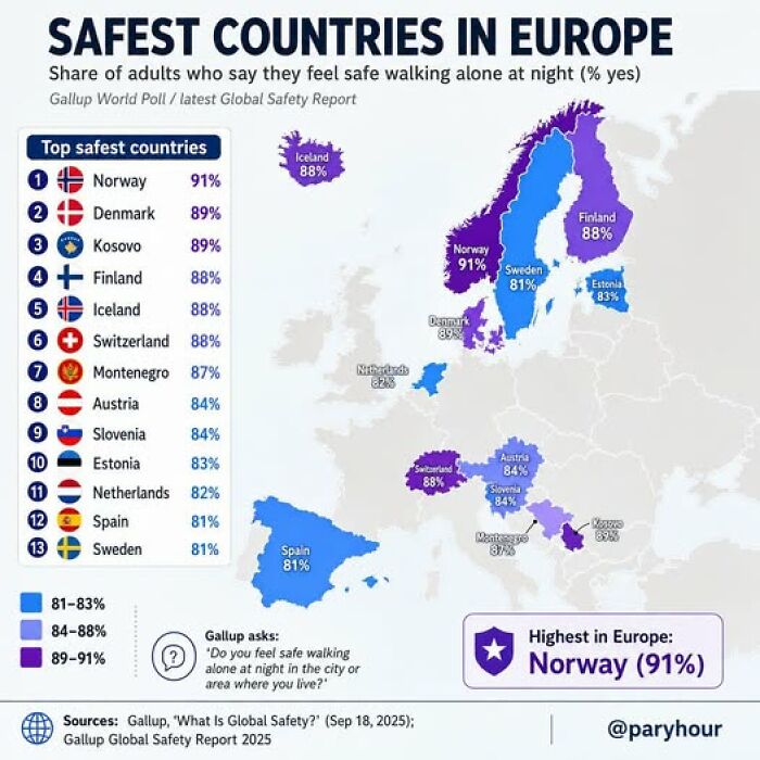
Mapping got fancier over centuries. A guy named Ptolemy in the 2nd century A.D. figured out a way to plot places with latitude and longitude, partly because he wanted better horoscopes (yeah, astrology meets geography here!).
His system stuck around and helped shape maps for ages, even if it went undercover in Europe for a while.
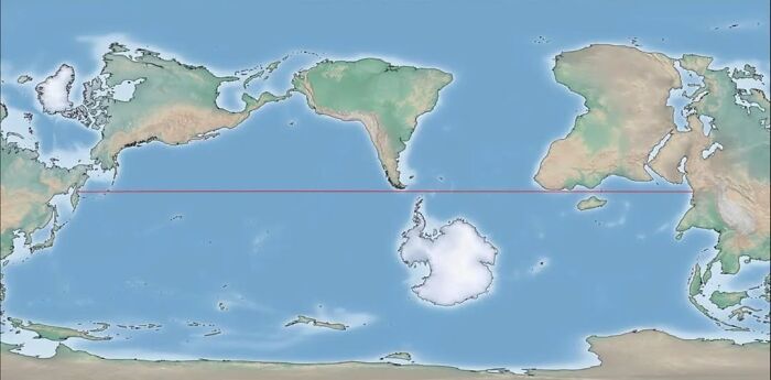
Fast forward to the Renaissance, when explorers and rulers needed maps that actually made sense. A clever cartographer named Mercator whipped up a new style of map that sailors loved - it let them draw straight lines on a round world.
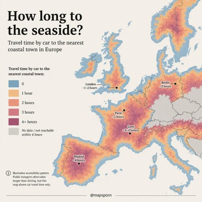
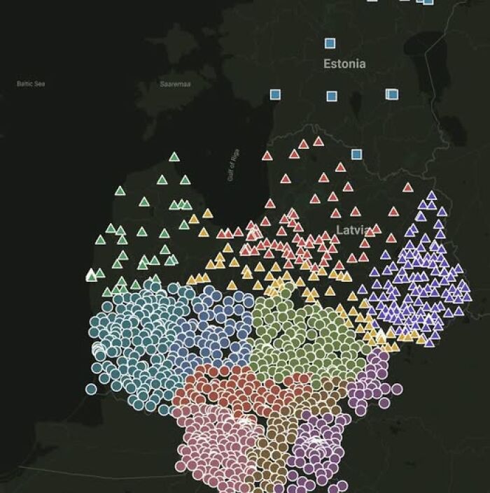
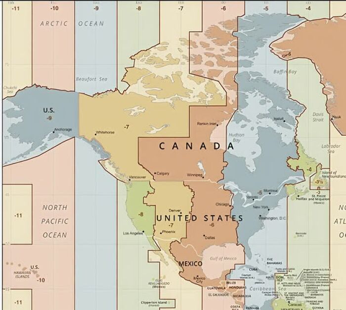
But heads up: Mercator’s map makes places near the poles look like giants and shrinks places near the equator. So, Africa looks surprisingly tiny, and places like Greenland look HUGE. Mind blown, right?
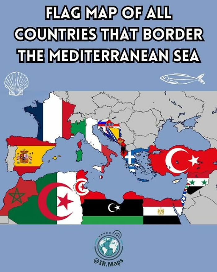
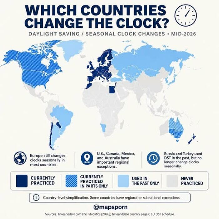
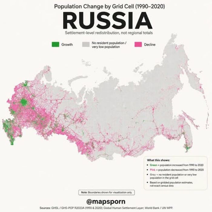
Maps started to get artistic and detailed, showing not just places but even individual buildings! Some mapmakers even charged businesses extra to get their spot on the map.
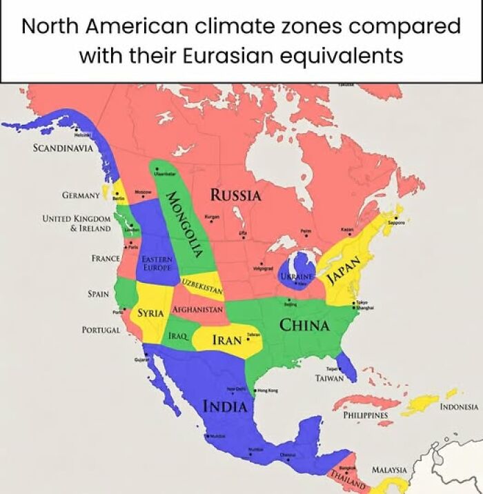
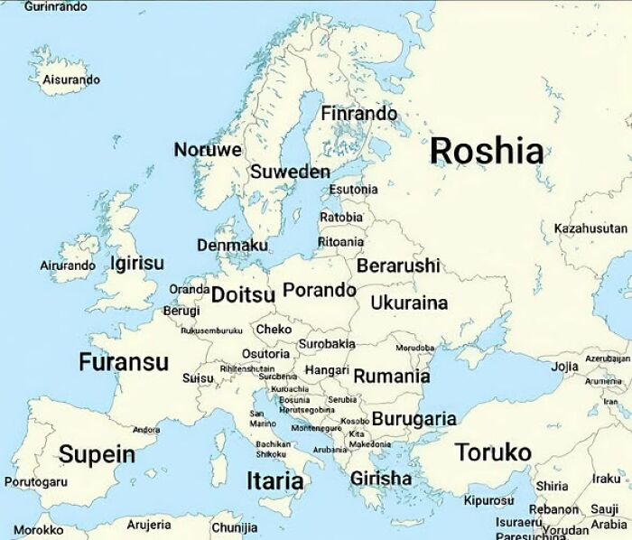
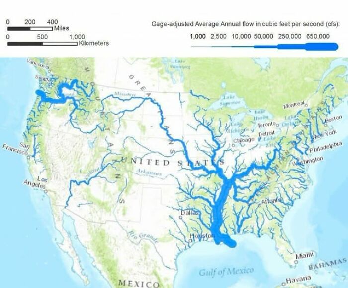




Maps can also be a bit sneaky. In the late 1800s, some maps colored neighborhoods by income and crime to highlight poverty - but sometimes they accidentally made stereotypes way worse.
Maps have power, so it’s smart to look at them with a curious and critical eye.
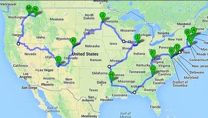
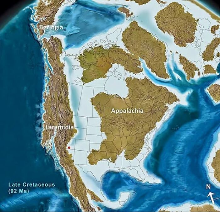
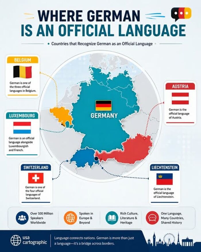
So yeah, maps aren’t just for finding your way - they tell stories, reveal secrets, and sometimes make you go “Wait, what?!” The next time you see a map, take a closer look. You might find some cool surprises hiding in plain sight!










37
0